When a site visit begins, it is tempting to mark attractive basket locations first. Resist that urge long enough to walk the land as a visitor. Notice where you arrive, where the path naturally pulls you, what you can see from a clearing and where the ground seems to ask you to turn. Those observations can reveal a route that belongs to the place rather than a sequence forced onto it.
Routing is the arrangement of holes and the connective movement between them. It has to accommodate play, maintenance, other land users and the landscape’s limits. A strong plan is not simply short or compact. It is understandable, safe to navigate and proportionate to the available terrain. It gives each hole a beginning and an end, then makes the next beginning discoverable without making people cross an active landing area.
Start with a movement map
Draw the site boundary, entrances, existing trails, roads, water, steep grades, sensitive habitat and places where people already gather. Do not treat existing use as blank space. A community path may be a valued daily route; a service lane might be the only reliable maintenance access. Ask who uses each area and at what times. Seasonal use matters too: a low wet swale in summer can become a barrier after rain, while a winter trail can expose a different desire line.
On a first sketch, mark possible tee and target zones with broad circles rather than precise pins. Connect them with arrows for player movement. Then draw likely disc-flight areas separately. The separation is useful: foot travel and flight should not be assumed to occupy the same corridor safely just because the lines look tidy on a plan. Add the direction of travel for each group and identify places where people could meet, wait or be surprised by approaching play.
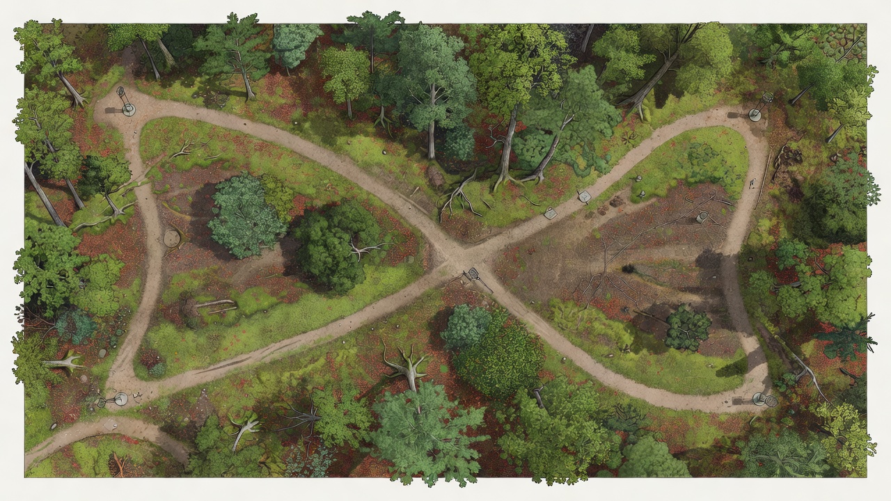
Test transitions as carefully as holes
For every proposed basket, ask how a group reaches the next tee. Can they see the direction of travel? Is the route obvious from the basket without relying on a tiny sign? Does it pass close to another tee, a likely landing zone or a public trail? Will a group waiting to play block people walking through? If the transition is confusing on a quiet weekday, tournament crowds will not make it clearer.
Distance is only one part of a transition’s cost. A short walk with a blind crossing can be more difficult than a longer path that remains visible and separated. A modest rise may be manageable when the path is firm and direct; the same grade becomes tiring if the route doubles back, narrows or runs through loose ground. Observe the entire journey with a loaded bag, not just a line on a map.
A course’s rhythm lives in the spaces between its throws.Routing fieldnote
Make the route legible
Wayfinding should confirm what the land already suggests. A tee sign can provide orientation and hole information, but it cannot repair a route that turns behind an unseen thicket or sends players toward the wrong fairway. Use sightlines, consistent sign placement and simple directional markers at genuine decision points. Avoid adding signs everywhere: too much instruction can become visual clutter and still leave the important junction ambiguous.
At each transition, check the view from the height and position of a person carrying equipment. Look for the next tee marker, a path opening, a landmark or another reliable cue. If the route is not visible, consider whether a small path adjustment or careful vegetation management can make it readable without clearing more ground than necessary. Mark the choice on a route plan, and verify it on site before installation.
Separate traffic and protect shared use
Public access changes the routing problem. A park trail, dog-walking loop or maintenance route may pass through the property. Map its actual use, including informal tracks, then decide where users can share space and where a safer separation is needed. Never assume a sign alone makes a crossing safe. Sight distance, speed, group behaviour and the consequences of a missed throw all matter. Where conflicts cannot be reduced to an acceptable level by route changes or operating measures, reconsider the hole.
Walk the proposed course in both directions. A player’s approach to a tee can reveal a conflict that is invisible when walking from the preceding basket. Visit at different times if the site’s use varies, and ask land managers about scheduled activities, maintenance windows and seasonal closures. Keep notes on the location and nature of each conflict rather than writing a vague warning to “be careful.”
Build a route that can be maintained
Every path creates a maintenance obligation. Consider drainage, erosion, mowing access, fallen limbs, surface repair and the movement of equipment. A route that depends on a narrow muddy cut-through may be easy to draw but costly to keep open. Preserve practical access to baskets and tees without making maintenance vehicles cross sensitive areas unnecessarily. Specify which surfaces need hardening and where a natural tread is appropriate, based on actual use and soil response.
It helps to annotate a route plan with transition length, slope, surface, visibility, crossings and a brief maintenance note. This makes review more concrete. The question is not whether a line is elegant on paper, but whether it remains legible after leaves fall, after a wet week, during a crowded event and while routine work is underway.
Use a repeatable walk-through
Take a draft route to the ground with another person who has not studied the plan. Walk from the entrance through every proposed hole in sequence. Ask them to describe where they believe to go next, where they expect play to come from and which locations feel uncertain. Record observations before explaining the design. Their hesitation points to a real information problem, not a failure of attention.
Revise the map, then repeat the walk. Mark changes with a version date so landowners, designers and event planners discuss the same draft. A small change to one tee can improve several transitions; conversely, a convenient shortcut may introduce a conflict elsewhere. Routing decisions are connected, so judge each adjustment across the full circuit.
A route review plate
Before settling the plan, prepare one annotated plate that includes the course sequence, walking links, entrances, shared trails, crossings, service access and sensitive areas. Add a simple key, a north indicator and notes for uncertain locations. Use a separate line style for flight corridors and player paths. Where a crossing remains, explain how it will be managed and what further site review is needed. This does not replace detailed safety assessment or local approvals; it makes the questions visible early.
The finished walk should feel coherent without demanding that the ground become something it is not. Let terrain and existing paths guide the sequence where they help, and be willing to move a hole when the transition creates repeated confusion or an avoidable conflict. The best route is not always the most direct one. It is the one that keeps the whole visit understandable, considerate and workable for the people who use the land.